This study was funded by Natural England and commissioned by Suffolk Wildlife Trust to gather information on the natural assets of the landscape between Diss and Knettishall. It investigates the potential for restoring wildlife sites and reconnecting them through new habitat corridors and expansion of existing sites. It proposes a new vision for nature-based land management accommodating farming and promoting other benefits to society, such as management of water flows, reduced loss of sediment, nutrient and carbon from the land, and better access to nature.
The Vision
A landscape where human activity thrives in sympathy with a recovered nature. It contains the full range of habitats characteristic of the headwaters of the Waveney and Little Ouse Rivers. This nature-enriched landscape re-makes the link between the Broads and the Brecks natural areas, connecting the habitats and species of each. It remains an essentially agricultural landscape, retaining historical boundaries and patterns. The valley slopes are a mosaic of open heath, grassland, scrub and woodland. In the floodplain, dynamic and varied rivers with good water quality flow through peatlands with fens and wet woodland, and in areas of silt and clay soils there is wet grassland with water-filled ditches. In the wider landscape, regenerative farming practices provide space and connectivity for wildlife, and rebuild soil structure and carbon stores. In this landscape, field hedgerows, margins and ponds are restored, lost populations of typical species rebuilt, and pollinators and other invertebrates are abundant in the flower-rich fields. Water, sediment and nutrients are held on the agricultural land and restored water tables ensure carbon is retained in peat stores. Fens, woods and scrub remove more carbon from the atmosphere. The landscape will help mitigate climate change, while the habitats and species will be more resilient to face the challenges the future will bring.
Figure 1
Location of the core and wider project areas.

Figure 2
Increases in connectivity and area of sites managed for nature in the upper headwaters of the Waveney and Little Ouse rivers, 1990 and 2022.

Figure 3
Water Framework Directive water bodies in the project area.

Figure 4
Designated sites within and immediately beyond the project area.
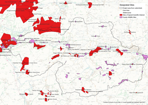
Figure 5
Soil types within the wider area.
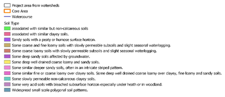
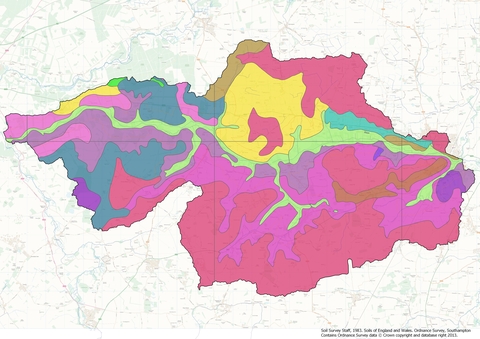
Figure 6
Agricultural Land Classification within and close to the project area.
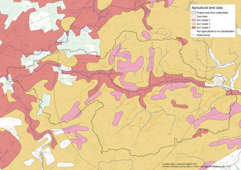
Figure 7
Location of ponds within the wider project area in 1950 and 2020.


Figure 8
Watercourses within the Wider Area showing potential restoration works.

Figure 9
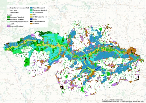
Current broad habitat types within the project area.

Figure 10
Vision Map for future habitat recovery within the project area.
